Description
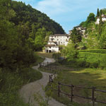
This fascinating itinerary enters the beautiful Valle dei Mulini – Mill Valley -, where once stood different mills, which were operated by the torrent of Gusa-Tesina. Of these, only one mill from the 17th century has been preserved. The trail is 10.2 km long, has a height difference of 220 m and is classified as easy to moderate walk. The starting point is Costermano. If you commit the track in counter-clockwise direction, you reach the historic center of Costermano, a terrace overlooking Lake Garda, with the palace Becelli-Rizzardi (centuries XV-XVI) and the picturesque residential district. Following the path that runs parallel to the highway, you go downhill now. This itinerary offers the possibility to see the different fluvial-glacial deposit layers. The Mill Valley offers interesting geological and naturalistic attractions. Its vegetation is really interesting – here has been remarked the rare occurence of Gypsophila papillosa. The track is also equipped with a fitness trail. After crossing the road that leads to Garda, go to Le Giare and then to the locality Cà Nova, where the path leads you uphill to the municipality of Costermano and to locality Baesse. From here you return to the starting point going along the German Military Cemetery of the Second World War with over 22,000 graves – the third most important in Italy.


